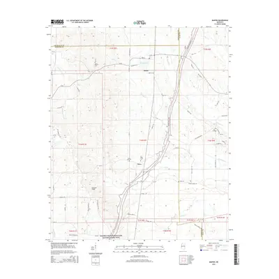
2015 Map of Mantee
USGS Topo · Published 2015About this map
Mantee and the smaller community of Dancy anchor this mid-2010s landscape where Webster, Chickasaw, and Clay counties meet. The geography is defined by a dense network of tributaries including Old Field Cr, Sewayiah Cr, and Line Cr, reflecting the low-lying, water-rich environment of north-central Mississippi. Cultural history is preserved in a series of local burial grounds, such as Mount Pleasant Cem and Wake Forest Cem, which serve as vital landmarks for genealogical research in this rural region. The presence of the Topashaw Cr Canal in the west and Choctaw Ridge in the southwest suggests a landscape shaped by both natural elevation and deliberate water management. Traces of historical transit and family homesteads are evident in the naming of local routes like Hunters Run Rd and Ervin White Rd.
Find a feature on this map
80 named features on this map. Tap any name to fly to it.
Don’t see what you’re looking for? This feature index may not catch every label — zoom into the map to look around manually.
Map Details
Editions of this 2015 Mantee Map
This is the sole edition of this map. No revisions or reprints were ever made.
Other maps of this area

1953 · West Point
USGS Topo · 1:250,000

1958 · West Point
USGS Topo · 1:250,000

1959 · Van Vleet
USGS Topo · 1:62,500

1959 · Pheba
USGS Topo · 1:62,500

1963 · West Point
USGS Topo · 1:250,000

1972 · Maben
USGS Topo · 1:24,000

1972 · Atlanta
USGS Topo · 1:24,000

1972 · Sapa
USGS Topo · 1:24,000

1972 · Hohenlinden
USGS Topo · 1:24,000

1972 · Mantee
USGS Topo · 1:24,000