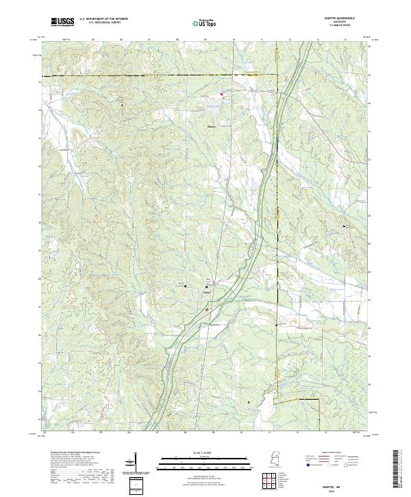
2024 Map of Mantee
USGS Topo · Published 2024About this map
The Natchez Trace Parkway carves a sweeping diagonal through this rural landscape on the border of Webster, Clay, and Chickasaw counties. Centered on the town of Mantee, the area is defined by a dense network of watercourses and topographical landmarks, most notably the Choctaw Ridge and the Topashaw Creek Canal. Small crossroads like Dancy are situated among numerous family and community landmarks, including Wake Forest Cem and Mount Hope Cem. The survey reveals a landscape where modern infrastructure meets traditional settlement patterns, with drainage features such as Old Field Creek and Line Creek feeding toward the Big Black River. For genealogists, the map is a valuable resource for identifying the precise locations of rural burials and the original township and range divisions that governed early land patents in this section of northern Mississippi.
Find a feature on this map
78 named features on this map. Tap any name to fly to it.
Don’t see what you’re looking for? This feature index may not catch every label — zoom into the map to look around manually.
Map Details
Editions of this 2024 Mantee Map
This is the sole edition of this map. No revisions or reprints were ever made.
Other maps of this area

1953 · West Point
USGS Topo · 1:250,000

1958 · West Point
USGS Topo · 1:250,000

1959 · Van Vleet
USGS Topo · 1:62,500

1959 · Pheba
USGS Topo · 1:62,500

1963 · West Point
USGS Topo · 1:250,000

1972 · Maben
USGS Topo · 1:24,000

1972 · Atlanta
USGS Topo · 1:24,000

1972 · Sapa
USGS Topo · 1:24,000

1972 · Hohenlinden
USGS Topo · 1:24,000

1972 · Mantee
USGS Topo · 1:24,000