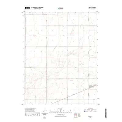
2018 Map of Manter
USGS Topo · Published 2018About this map
Manter sits at the heart of this Stanton County landscape, organized by a strict grid of section roads that define the agricultural character of western Kansas. The town site itself is concentrated in the southeast, featuring a small street network including Madison St and 1st Ave. Just outside the town limits, the Manter Cem provides a local genealogical point of interest for researchers tracing area families. The surrounding terrain is largely level, though the path of Beaty Cr introduces subtle drainage patterns through the southern sections. This survey illustrates the enduring importance of the Public Land Survey System, with township boundaries like t28s r43w and t29s r42w clearly delineated. The road network, including the long stretches of N Manter Grade and S Manter Grade, highlights the connectivity required for this remote farming community.
Find a feature on this map
32 named features on this map. Tap any name to fly to it.
Don’t see what you’re looking for? This feature index may not catch every label — zoom into the map to look around manually.
Map Details
Editions of this 2018 Manter Map
This is the sole edition of this map. No revisions or reprints were ever made.
Other maps of this area

1891 · Albany
USGS Topo · 1:125,000

1892 · Vilas
USGS Topo · 1:125,000

1893 · Albany
USGS Topo · 1:125,000

1900 · Syracuse
USGS Topo · 1:125,000

1920 · Syracuse
USGS Topo · 1:125,000

1955 · La Junta
USGS Topo · 1:250,000

1955 · Dodge City
USGS Topo · 1:250,000

1958 · La Junta
USGS Topo · 1:250,000

1958 · Dodge City
USGS Topo · 1:250,000

1959 · Dodge City
USGS Topo · 1:250,000