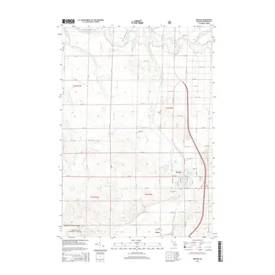
2014 Map of Manton
USGS Topo · Published 2014About this map
The city of Manton serves as the primary hub of this northern Michigan landscape, situated at the junction of several regional transit routes. To the west, the Manistee National Forest defines the wooded character of the region, where the Manistee River and the N Country National Scenic Trail wind through the township. The area's settlement history is well-preserved through a concentration of burial sites, including Liberty Cem, Greenwood Cem, and Fairview Cem. A smaller community center at Gilbert is anchored by the Gilbert Lutheran Cem, reflecting the religious and social organization of the rural population. Water resources are central to the geography here, from the larger Billings Lake near the city center to smaller features like Buttermilk Lake and Mill Pond, which historically supported local industry and recreation. The rigid grid of the Public Land Survey System, marked by designations like t24n r9w, contrasts with the organic flow of Manton Cr and Buttermilk Cr.
Find a feature on this map
53 named features on this map. Tap any name to fly to it.
Don’t see what you’re looking for? This feature index may not catch every label — zoom into the map to look around manually.
Map Details
Editions of this 2014 Manton Map
This is the sole edition of this map. No revisions or reprints were ever made.
Other maps of this area

1954 · Traverse City
USGS Topo · 1:250,000

1956 · Fife Lake
USGS Topo · 1:62,500

1956 · Kingsley
USGS Topo · 1:62,500

1956 · Mesick
USGS Topo · 1:62,500

1956 · Cadillac North
USGS Topo · 1:62,500

1958 · Traverse City
USGS Topo · 1:250,000

1983 · Cadillac
USGS Topo · 1:100,000

1983 · Manton
USGS Topo · 1:25,000

1983 · Cadillac North
USGS Topo · 1:24,000

1983 · Traverse City
USGS Topo · 1:100,000