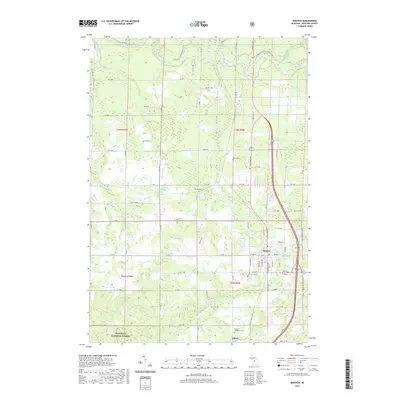
2019 Map of Manton
USGS Topo · Published 2019About this map
Manton sits at the intersection of local history and modern transit, serving as a focal point for Wexford County commerce and community. The landscape is defined by its water and woods, with the northern boundary traced by the winding Manistee River and the southern reaches protected within the Manistee National Forest. This 2019 survey documents a network of rural cemeteries including Liberty Cem, Greenwood Cem, and Fairview Cem, which provide essential touchstones for genealogical research in the area. The terrain is dotted with significant water bodies like Billings Lake, Buttermilk Lake, and the Mill Pond, illustrating the importance of natural hydrology to the region's development. Long-distance recreation is also prominent, with the N Country National Scenic Trail and the Shore to Shore Trail traversing the timbered sections of the quadrangle.
Find a feature on this map
69 named features on this map. Tap any name to fly to it.
Don’t see what you’re looking for? This feature index may not catch every label — zoom into the map to look around manually.
Map Details
Editions of this 2019 Manton Map
This is the sole edition of this map. No revisions or reprints were ever made.
Other maps of this area

1954 · Traverse City
USGS Topo · 1:250,000

1956 · Fife Lake
USGS Topo · 1:62,500

1956 · Kingsley
USGS Topo · 1:62,500

1956 · Mesick
USGS Topo · 1:62,500

1956 · Cadillac North
USGS Topo · 1:62,500

1958 · Traverse City
USGS Topo · 1:250,000

1983 · Cadillac
USGS Topo · 1:100,000

1983 · Manton
USGS Topo · 1:25,000

1983 · Cadillac North
USGS Topo · 1:24,000

1983 · Traverse City
USGS Topo · 1:100,000