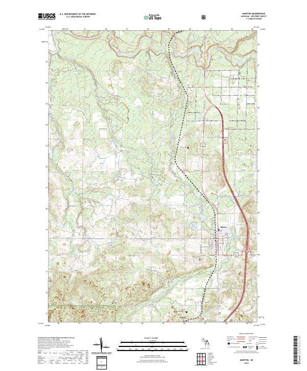
2023 Map of Manton
USGS Topo · Published 2023About this map
The Manistee River winds through the northern reaches of this Wexford County landscape, defining a terrain shaped by water and timber history. Centered on the city of Manton, the area exhibits a transition from established residential blocks near Billings Lake and Mill Pond to the expansive wooded tracts of the Manistee National Forest in the south. For local historians and genealogists, the map preserves the location of several rural burial grounds, including Greenwood Cem, Fairview Cem, and Liberty Cem, as well as the small settlement of Gilbert. Modern recreation is marked by the path of the North Country National Scenic Trl, which meanders across the river valley and through the forest, following the same natural corridors that once supported the region's early development. The grid of forest roads and sections like t24n r9w provides a clear framework for tracing property boundaries and the evolution of Wexford County's interior.
Find a feature on this map
68 named features on this map. Tap any name to fly to it.
Don’t see what you’re looking for? This feature index may not catch every label — zoom into the map to look around manually.
Map Details
Editions of this 2023 Manton Map
This is the sole edition of this map. No revisions or reprints were ever made.
Other maps of this area

1954 · Traverse City
USGS Topo · 1:250,000

1956 · Fife Lake
USGS Topo · 1:62,500

1956 · Kingsley
USGS Topo · 1:62,500

1956 · Mesick
USGS Topo · 1:62,500

1956 · Cadillac North
USGS Topo · 1:62,500

1958 · Traverse City
USGS Topo · 1:250,000

1983 · Cadillac
USGS Topo · 1:100,000

1983 · Manton
USGS Topo · 1:25,000

1983 · Cadillac North
USGS Topo · 1:24,000

1983 · Traverse City
USGS Topo · 1:100,000