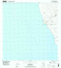
1995 Map of Manuka Bay
USGS Topo · Published 2000About this map
Volcanic activity defines this coastal stretch of the Big Island, where the Manukā Natural Area Reserve protects a landscape shaped by successive flows. The map details the jagged coastline from Kānewa‘a Point in the north down to Kaunā Point, illustrating how lava flow lines have historically altered the terrain. Of particular interest to those studying local geology and land formation are the numerous kīpuka—islands of older vegetation surrounded by more recent flows—such as Kipukakaulanamauna, Kīpukamālua, and Kīpukakaupua‘a. The remote shoreline is punctuated by small inlets like Manukā Bay and Kaiakekua, while the inland area is divided between the South Kona District and Ka‘ū District. Small landmarks like the Kamoi and ‘Ahuloa areas provide reference points within this sparsely settled region of the Pacific Ocean coast.
Find a feature on this map
19 named features on this map. Tap any name to fly to it.
Don’t see what you’re looking for? This feature index may not catch every label — zoom into the map to look around manually.
Map Details
Editions of this 1995 Manuka Bay Map
This is the sole edition of this map. No revisions or reprints were ever made.
Other maps of this area

1928 · Hoopuloa
USGS Topo · 1:62,500

1954 · Hawaii South
USGS Topo · 1:250,000

1959 · Hawaii South
USGS Topo · 1:250,000

1961 · Hawaii South
USGS Topo · 1:250,000

1962 · Hawaii South
USGS Topo · 1:250,000

1962 · Milolii
USGS Topo · 1:24,000
1962 · Manuka Bay
USGS Topo · 1:24,000

1962 · Pohue Bay
USGS Topo · 1:24,000

1962 · Papa
USGS Topo · 1:24,000

1975 · Hawaii
USGS Topo · 1:250,000