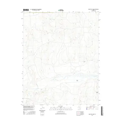
2016 Map of Many Post Camp
USGS Topo · Published 2016About this map
Many Post Camp sits on a high terrace overlooking the vast drainage system of the Texas Panhandle, where the wide, braided bed of the Canadian River cuts through the landscape. This 2016 survey illustrates the intricate network of seasonal waterways and springs that have sustained ranching and travel in this arid region for generations. Notable water sources such as Oil-Well Spring and various creeks like Sand Cr and Moneto Cr provide vital points of interest for researchers tracing historical movement through the territory.
Find a feature on this map
10 named features on this map. Tap any name to fly to it.
Don’t see what you’re looking for? This feature index may not catch every label — zoom into the map to look around manually.
Map Details
Editions of this 2016 Many Post Camp Map
This is the sole edition of this map. No revisions or reprints were ever made.
Other maps of this area

1954 · Tucumcari
USGS Topo · 1:250,000

1958 · Tucumcari
USGS Topo · 1:250,000

1966 · Alamocitos Camp
USGS Topo · 1:24,000

1966 · Big George Tank
USGS Topo · 1:24,000

1966 · Torrea Peak
USGS Topo · 1:24,000

1971 · Proctor Ranch
USGS Topo · 1:24,000

1971 · Channing NW
USGS Topo · 1:24,000

1971 · Many Post Camp
USGS Topo · 1:24,000
1971 · Torrey House
USGS Topo · 1:24,000
1971 · Humdinger Spring
USGS Topo · 1:24,000