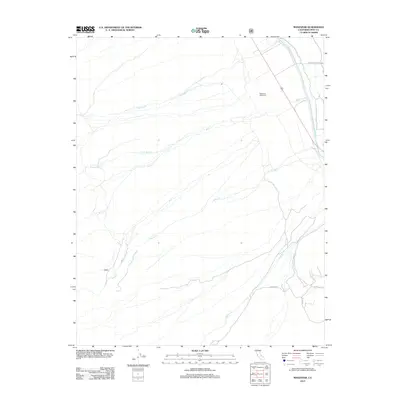
2012 Map of Manzanar
USGS Topo · Published 2012About this map
Manzanar (Historical) stands as a focal point in this eastern California landscape, marking the site of the former relocation center. The terrain is defined by a series of parallel watercourses descending from the high peaks to the west, including Shepherd Cr, Bairs Cr, and George Cr. These streams cross the arid valley floor, intersecting with the Los Angeles Aqueduct as it travels south. Toward the southeast, the settlement of Moffat and Moffat Ranch Rd indicate the ranching history of Inyo County. The infrastructure is sparse, characterized by local routes like Hogback Rd and the evocatively named Movie Rd, reflecting the area's dual identity as a site of agricultural effort and a backdrop for cinema.
Find a feature on this map
12 named features on this map. Tap any name to fly to it.
Don’t see what you’re looking for? This feature index may not catch every label — zoom into the map to look around manually.
Map Details
Editions of this 2012 Manzanar Map
This is the sole edition of this map. No revisions or reprints were ever made.
Other maps of this area

1907 · Mt. Whitney
USGS Topo · 1:125,000

1919 · Mt. Whitney
USGS Topo · 1:125,000

1937 · Mt. Whitney
USGS Topo · 1:125,000

1948 · Fresno
USGS Topo · 1:250,000

1951 · Independence
USGS Topo · 1:62,500

1953 · Mt. Pinchot
USGS Topo · 1:62,500

1955 · Fresno
USGS Topo · 1:250,000

1956 · Fresno
USGS Topo · 1:250,000

1956 · Mount Whitney
USGS Topo · 1:62,500

1958 · Fresno
USGS Topo · 1:250,000