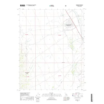
2018 Map of Manzanar
USGS Topo · Published 2018About this map
Manzanar National Historic Site occupies a central position on this landscape where the eastern slope of the Sierra Nevada meets the western edge of the Mojave Desert. The map reveals a complex intersection of historical preservation and modern utility, as the grid of the former internment camp sits adjacent to the Los Angeles Aqueduct, a critical piece of California's water infrastructure. Numerous drainage creeks, including Shepherd Cr and Bairs Cr, descend from the Inyo National Forest toward the valley floor. The road network, including the evocative Movie Rd and Upper Alabama Hills Trail, highlights the area's significance as a cultural and recreational corridor in Inyo County. This survey provides a precise look at the land use and water management patterns that continue to shape the Owens Valley region.
Find a feature on this map
18 named features on this map. Tap any name to fly to it.
Don’t see what you’re looking for? This feature index may not catch every label — zoom into the map to look around manually.
Map Details
Editions of this 2018 Manzanar Map
This is the sole edition of this map. No revisions or reprints were ever made.
Other maps of this area

1907 · Mt. Whitney
USGS Topo · 1:125,000

1919 · Mt. Whitney
USGS Topo · 1:125,000

1937 · Mt. Whitney
USGS Topo · 1:125,000

1948 · Fresno
USGS Topo · 1:250,000

1951 · Independence
USGS Topo · 1:62,500

1953 · Mt. Pinchot
USGS Topo · 1:62,500

1955 · Fresno
USGS Topo · 1:250,000

1956 · Fresno
USGS Topo · 1:250,000

1956 · Mount Whitney
USGS Topo · 1:62,500

1958 · Fresno
USGS Topo · 1:250,000