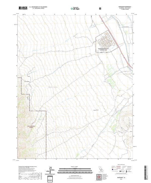
2021 Map of Manzanar
USGS Topo · Published 2021About this map
Manzanar National Historic Site occupies a significant portion of this Owens Valley landscape, preserved as a site of forced relocation during World War II. The map details the former camp's grid system, including streets from 1st St. to 9th St. and lettered avenues from A St. to I St.. This structured human imprint sits in sharp contrast to the natural drainages flowing from the Sierra Nevada toward the Owens Valley floor, such as Shepherd Cr and Bairs Cr. The eastern portion of the map highlights the infrastructure of California's water history, notably the Los Angeles Aqueduct and Stevens Canal. Further south, the terrain shifts into the Alabama Hills and the northern reaches of the Mojave Desert, where Moffat Ranch Rd and Movie Rd provide access to the rocky foothills of the Inyo National Forest.
Find a feature on this map
42 named features on this map. Tap any name to fly to it.
Don’t see what you’re looking for? This feature index may not catch every label — zoom into the map to look around manually.
Map Details
Editions of this 2021 Manzanar Map
This is the sole edition of this map. No revisions or reprints were ever made.
Other maps of this area

1907 · Mt. Whitney
USGS Topo · 1:125,000

1919 · Mt. Whitney
USGS Topo · 1:125,000

1937 · Mt. Whitney
USGS Topo · 1:125,000

1948 · Fresno
USGS Topo · 1:250,000

1951 · Independence
USGS Topo · 1:62,500

1953 · Mt. Pinchot
USGS Topo · 1:62,500

1955 · Fresno
USGS Topo · 1:250,000

1956 · Fresno
USGS Topo · 1:250,000

1956 · Mount Whitney
USGS Topo · 1:62,500

1958 · Fresno
USGS Topo · 1:250,000