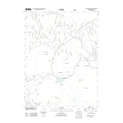
2012 Map of Manzanita Lake
USGS Topo · Published 2012About this map
Manzanita Lake and the nearby settlement of Summertown anchor this 2012 survey of a geologically active landscape in Shasta County. The terrain is dominated by the volcanic legacy of Chaos Crater and the stark Chaos Crags, which give way to the sprawling rock debris of the Chaos Jumbles. This area serves as a significant recreational and transit corridor, where Manzanita Cr flows toward Reflection Lake and the Lily Pond. Historical passage through the mountains is marked by Noble Pass and Nobles Pass, while the modern infrastructure includes the Lost Creek Diversion Flume. The map details numerous backcountry sites, from the Manzanita Lake Campground to the more remote Crags Campground, alongside distinctive natural features like Deep Hole and Eskimo Hill.
Find a feature on this map
33 named features on this map. Tap any name to fly to it.
Don’t see what you’re looking for? This feature index may not catch every label — zoom into the map to look around manually.
Map Details
Editions of this 2012 Manzanita Lake Map
This is the sole edition of this map. No revisions or reprints were ever made.
Other maps of this area

1886 · Lassen Peak
USGS Topo · 1:250,000

1892 · Lassen Peak
USGS Topo · 1:250,000

1894 · Lassen Peak
USGS Topo · 1:250,000

1935 · Burney
USGS Topo · 1:96,000

1935 · Paynes Creek
USGS Topo · 1:96,000

1939 · Burney
USGS Topo · 1:125,000

1939 · Halls Flat
USGS Topo · 1:125,000

1941 · Mineral
USGS Topo · 1:125,000

1955 · Westwood
USGS Topo · 1:250,000

1956 · Lassen Peak
USGS Topo · 1:62,500