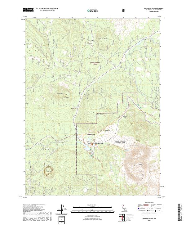
2021 Map of Manzanita Lake
USGS Topo · Published 2021About this map
Summertown and the surrounding volcanic terrain define this 2021 study of the northern reaches of Lassen Volcanic National Park. The map documents a complex landscape of geothermal and geological significance, centered on the waters of Manzanita Lake and Reflection Lake. The southern portion of the sheet is dominated by the stark formations of Chaos Crags and the Chaos Crater, providing a detailed look at the area's explosive history.
Find a feature on this map
35 named features on this map. Tap any name to fly to it.
Don’t see what you’re looking for? This feature index may not catch every label — zoom into the map to look around manually.
Map Details
Editions of this 2021 Manzanita Lake Map
This is the sole edition of this map. No revisions or reprints were ever made.
Other maps of this area

1886 · Lassen Peak
USGS Topo · 1:250,000

1892 · Lassen Peak
USGS Topo · 1:250,000

1894 · Lassen Peak
USGS Topo · 1:250,000

1935 · Burney
USGS Topo · 1:96,000

1935 · Paynes Creek
USGS Topo · 1:96,000

1939 · Burney
USGS Topo · 1:125,000

1939 · Halls Flat
USGS Topo · 1:125,000

1941 · Mineral
USGS Topo · 1:125,000

1955 · Westwood
USGS Topo · 1:250,000

1956 · Lassen Peak
USGS Topo · 1:62,500