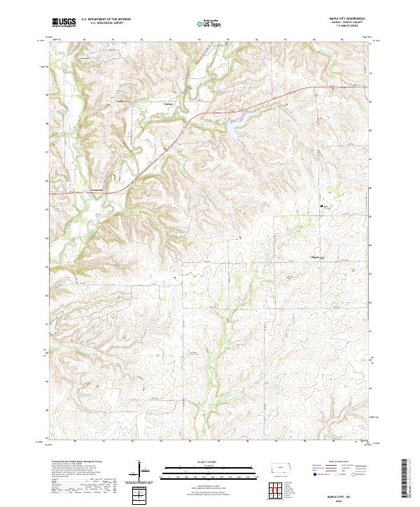
2022 Map of Maple City
USGS Topo · Published 2022About this map
Maple City sits as a central hub in this section of Cowley County, surrounded by a network of drainage systems that define the rural Kansas prairie. The landscape is deeply carved by water, with Grouse Creek winding through the center, joined by numerous tributaries including Little Beaver Cr and Shellrock Cr. This topography creates a series of ridges and valleys that the local road system, including Co RD 6 and Co RD 13, must navigate.
Find a feature on this map
32 named features on this map. Tap any name to fly to it.
Don’t see what you’re looking for? This feature index may not catch every label — zoom into the map to look around manually.
Map Details
Editions of this 2022 Maple City Map
This is the sole edition of this map. No revisions or reprints were ever made.
Other maps of this area

1889 · Burden
USGS Topo · 1:125,000

1916 · Foraker
USGS Topo · 1:62,500

1935 · Kaw
USGS Topo · 1:62,500

1955 · Wichita
USGS Topo · 1:250,000

1955 · Enid
USGS Topo · 1:250,000

1958 · Enid
USGS Topo · 1:250,000

1958 · Wichita
USGS Topo · 1:250,000

1962 · Dexter SW
USGS Topo · 1:24,000

1962 · Dexter
USGS Topo · 1:24,000

1963 · Kaw City NW
USGS Topo · 1:24,000