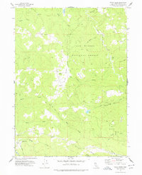
1977 Map of Maple Creek
USGS Topo · Published 1978About this map
Six Rivers National Forest dominates this section of Humboldt County, where the landscape is defined by the steep drainages of Redwood Creek and its many tributaries. The area reflects a rugged ranching and timber-oriented economy in the late 1970s, evidenced by scattered family outposts such as Russ Ranch, Carson Ranch, and Rock Ranch. A small settlement at Maple Creek sits near the confluence of Boulder Creek and the Mad River, anchored by a local Substation. High-altitude clearings like Lake Prairie, High Prairie, and Heustis Prairie break up the dense canopy, while the presence of a Quarry and numerous Jeep Trails indicates active land use in this mountainous terrain. Genealogists and local historians can trace legacy landmarks from Fernwood in the north to the slopes of Snow Camp Mtn in the south, capturing a specific era of California's coastal range history.
Find a feature on this map
35 named features on this map. Tap any name to fly to it.
Don’t see what you’re looking for? This feature index may not catch every label — zoom into the map to look around manually.
Map Details
Editions of this 1977 Maple Creek Map
This is the sole edition of this map. No revisions or reprints were ever made.
Other maps of this area

1914 · Pilot Creek
USGS Topo · 1:62,500

1915 · Big Bar and Vicinity
USGS Topo · 1:250,000

1922 · Korbel
USGS Topo · 1:62,500

1922 · China Flat
USGS Topo · 1:62,500

1922 · Kneeland
USGS Topo · 1:62,500

1945 · Blue Lake
USGS Topo · 1:62,500

1950 · Iaqua Buttes
USGS Topo · 1:62,500

1951 · Pilot Creek
USGS Topo · 1:62,500

1951 · Blue Lake
USGS Topo · 1:62,500

1952 · Willow Creek
USGS Topo · 1:62,500