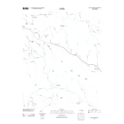
2013 Map of Maple Springs
USGS Topo · Published 2013About this map
Blue Ridge Pkwy winds across the high northern ridges of this Wilkes County landscape, passing through Jeffress Park and offering scenic vistas at Thomkins Knob Overlook and Cascade Overlook. The terrain is defined by a series of steep ridges including Husons Ridge and Ivy Point Ridge, with water flowing down towards the valley settlements. Along the central corridor, the S Prong Lewis Fork is crossed by the NC-1389 Wade Harris Bridge near the community of Harley. In the western portion of the map, the headwaters of Stony Fork and its tributaries like Flowers Br carve deep valleys between peaks such as Wolf Knob and Chestnut Mountain. The map illustrates a rural network of roads connecting small settlements like Mount Zion and Maple Springs, reflecting a landscape dominated by its high-altitude topography and watercourses.
Find a feature on this map
103 named features on this map. Tap any name to fly to it.
Don’t see what you’re looking for? This feature index may not catch every label — zoom into the map to look around manually.
Map Details
Editions of this 2013 Maple Springs Map
This is the sole edition of this map. No revisions or reprints were ever made.
Other maps of this area

1889 · Wilkesboro
USGS Topo · 1:125,000

1891 · Wilkesboro
USGS Topo · 1:125,000

1893 · Cranberry
USGS Topo · 1:125,000

1895 · Cranberry
USGS Topo · 1:125,000

1899 · Cranberry
USGS Topo · 1:125,000

1902 · Cranberry
USGS Topo · 1:125,000

1936 · Blowing Rock
USGS Topo · 1:48,000

1942 · Blowing Rock
USGS Topo · 1:62,500

1953 · Winston-Salem
USGS Topo · 1:250,000

1955 · Winston-Salem
USGS Topo · 1:250,000