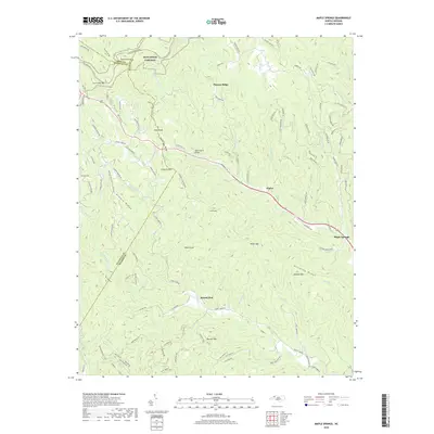
2019 Map of Maple Springs
USGS Topo · Published 2019About this map
Blue Ridge Parkway winds across the high ridgelines of the Blue Ridge, following the crest through the intersections of Ashe, Watauga, and Wilkes Counties. This 2019 survey captures the modern landscape of the North Carolina highlands, where deep drainages like S Prong Lewis Fork and Stony Fork carve through prominent terrain features such as Tomkins Knob and Fire Scale Mtn. The map highlights the sparse but established settlement patterns of the region, anchored by the Mountain View Baptist Church and the small community of Harley. Local infrastructure is visible at the Wade Harris Bridge, while the Mountains-to-Sea Trail offers a trace of the recreational corridors that define these mountains today. Numerous peaks, including Yates Knob and Johnson Mtn, overlook a network of secondary roads that connect isolated homesteads and small mountain hamlets.
Find a feature on this map
117 named features on this map. Tap any name to fly to it.
Don’t see what you’re looking for? This feature index may not catch every label — zoom into the map to look around manually.
Map Details
Editions of this 2019 Maple Springs Map
This is the sole edition of this map. No revisions or reprints were ever made.
Other maps of this area

1889 · Wilkesboro
USGS Topo · 1:125,000

1891 · Wilkesboro
USGS Topo · 1:125,000

1893 · Cranberry
USGS Topo · 1:125,000

1895 · Cranberry
USGS Topo · 1:125,000

1899 · Cranberry
USGS Topo · 1:125,000

1902 · Cranberry
USGS Topo · 1:125,000

1936 · Blowing Rock
USGS Topo · 1:48,000

1942 · Blowing Rock
USGS Topo · 1:62,500

1953 · Winston-Salem
USGS Topo · 1:250,000

1955 · Winston-Salem
USGS Topo · 1:250,000