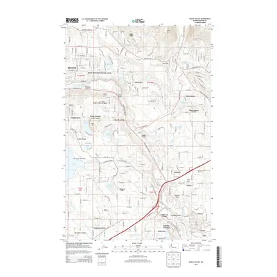
2014 Map of Maple Valley
USGS Topo · Published 2014About this map
The Cedar River carves a deep valley through this landscape, marking the transition from the eastern suburban reaches of Renton to the rural foothills of Squak Mtn. Evidence of the region’s industrial past remains visible through the Indian Coal Mine and Fire King Coal Mine, while the southern portion of the map is defined by the extensive Lake Youngs Watershed. The suburban development of East Renton Highlands and Covington contrasts with the numerous recreational and memorial sites, including the Tahoma National Cem and the Riverbend Recreational Vehicle Park.
Find a feature on this map
105 named features on this map. Tap any name to fly to it.
Don’t see what you’re looking for? This feature index may not catch every label — zoom into the map to look around manually.
Map Details
Editions of this 2014 Maple Valley Map
This is the sole edition of this map. No revisions or reprints were ever made.
Other maps of this area

1895 · Snohomish
USGS Topo · 1:125,000

1897 · Tacoma
USGS Topo · 1:125,000

1897 · Seattle
USGS Topo · 1:125,000

1900 · Tacoma
USGS Topo · 1:125,000

1913 · Cedar Lake
USGS Topo · 1:125,000

1921 · Sultan
USGS Topo · 1:125,000

1923 · Sultan
USGS Topo · 1:125,000

1949 · Maple Valley
USGS Topo · 1:24,000

1949 · Black Diamond
USGS Topo · 1:24,000

1949 · Renton
USGS Topo · 1:24,000