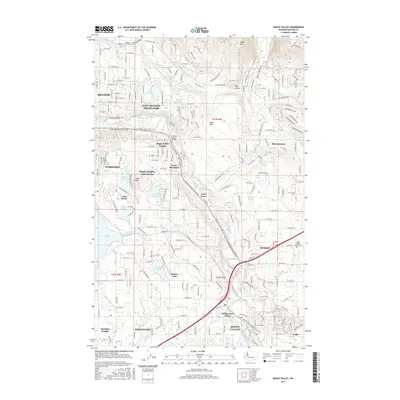
2017 Map of Maple Valley
USGS Topo · Published 2017About this map
Maple Valley and its surrounding communities are defined by a complex landscape of glacial lakes and river valleys southeast of Renton. The Cedar River cuts through the center of the sheet, flanked by the Cedar River Trail and the rising elevations of Cedar Mountain. This 2017 survey illustrates the suburban expansion and residential development patterns of the early 21st century, where established areas like East Renton Highlands and Covington meet more secluded enclaves such as Mirrormont and Wilderness Village.
Find a feature on this map
47 named features on this map. Tap any name to fly to it.
Don’t see what you’re looking for? This feature index may not catch every label — zoom into the map to look around manually.
Map Details
Editions of this 2017 Maple Valley Map
This is the sole edition of this map. No revisions or reprints were ever made.
Other maps of this area

1895 · Snohomish
USGS Topo · 1:125,000

1897 · Tacoma
USGS Topo · 1:125,000

1897 · Seattle
USGS Topo · 1:125,000

1900 · Tacoma
USGS Topo · 1:125,000

1913 · Cedar Lake
USGS Topo · 1:125,000

1921 · Sultan
USGS Topo · 1:125,000

1923 · Sultan
USGS Topo · 1:125,000

1949 · Maple Valley
USGS Topo · 1:24,000

1949 · Black Diamond
USGS Topo · 1:24,000

1949 · Renton
USGS Topo · 1:24,000