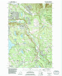
1995 Map of Maple Valley
USGS Topo · Published 1995About this map
The Cedar River carves a deep valley through this King County landscape, which by the mid-1990s shows a complex pattern of suburban growth and protected watersheds. The sprawling Lake Youngs Watershed dominates the western portion of the sheet, providing a stark contrast to the dense residential developments of Maplewood Heights and Maple Valley Heights. This era of development is reflected in the numerous schools appearing across the map, from Liberty High Sch in the north to Tahoma High Sch in the south.
Find a feature on this map
62 named features on this map. Tap any name to fly to it.
Don’t see what you’re looking for? This feature index may not catch every label — zoom into the map to look around manually.
Map Details
Editions of this 1995 Maple Valley Map
This is the sole edition of this map. No revisions or reprints were ever made.
Other maps of this area

1895 · Snohomish
USGS Topo · 1:125,000

1897 · Tacoma
USGS Topo · 1:125,000

1897 · Seattle
USGS Topo · 1:125,000

1900 · Tacoma
USGS Topo · 1:125,000

1913 · Cedar Lake
USGS Topo · 1:125,000

1921 · Sultan
USGS Topo · 1:125,000

1923 · Sultan
USGS Topo · 1:125,000

1949 · Maple Valley
USGS Topo · 1:24,000

1949 · Black Diamond
USGS Topo · 1:24,000

1949 · Renton
USGS Topo · 1:24,000