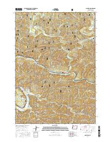
2017 Map of Mapleton
USGS Topo · Published 2017About this map
The Siuslaw River carves a deep path through the timberlands of Lane County, defining the development of small communities like Mapleton and Swisshome. This 2017 study illustrates the heavy influence of the logging industry on the landscape, notably with the Erskine Log Pond near Tide and Rainrock. The rugged topography is managed through an extensive network of forestry routes, including Natl Forest Develop Road 32 Rd, while the Knowles Creek Tunnel provides a critical passage through the high ridges. Genealogists can locate several local burial grounds, including the Deadwood Cem near the northern settlement of Deadwood and the Odd Fellows Mapleton Lodge 3139 Cem. These features reflect a history deeply tied to the natural resources and terrain of the Siuslaw National Forest.
Find a feature on this map
59 named features on this map. Tap any name to fly to it.
Don’t see what you’re looking for? This feature index may not catch every label — zoom into the map to look around manually.
Map Details
Editions of this 2017 Mapleton Map
This is the sole edition of this map. No revisions or reprints were ever made.
Other maps of this area

1918 · Mapleton
USGS Topo · 1:48,000

1919 · Earl
USGS Topo · 1:48,000

1940 · Mapleton
USGS Topo · 1:62,500

1941 · Blachly
USGS Topo · 1:62,500

1942 · Blachly
USGS Topo · 1:62,500

1942 · Roman Nose Mtn
USGS Topo · 1:62,500

1943 · Goodwin Peak
USGS Topo · 1:62,500

1945 · Mapleton
USGS Topo · 1:62,500

1945 · Roman Nose Mtn
USGS Topo · 1:62,500

1953 · Salem
USGS Topo · 1:250,000