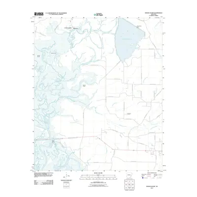
2011 Map of Marais Saline
USGS Topo · Published 2011About this map
Godfrey Landing and Blanchton overlook the meandering Saline River in this part of southern Arkansas. The landscape is dominated by the expansive Lake Georgia-Pacific, retained by the Lake Georgia-Pacific Dam, and the dense network of wetlands known as the Marais Saline. This riverine environment is defined by the shifting paths of waterways like Big Brushy Creek and Thompson Creek, which carve through the lowlands surrounding Gravel Ridge. Inland, the road network follows established corridors such as Arkadelphia Cemetery Rd, leading to the Arkadelphia Cemetery. The area reflects a reliance on river access points like Marie Saline Landing, highlighting the historical importance of the Ouachita River system for local transit and industry in Bradley and Ashley Counties.
Find a feature on this map
47 named features on this map. Tap any name to fly to it.
Don’t see what you’re looking for? This feature index may not catch every label — zoom into the map to look around manually.
Map Details
Editions of this 2011 Marais Saline Map
This is the sole edition of this map. No revisions or reprints were ever made.
Other maps of this area

1934 · Ingalls
USGS Topo · 1:48,000

1934 · Felsenthal
USGS Topo · 1:62,500

1937 · Felsenthal
USGS Topo · 1:62,500

1937 · Ingalls
USGS Topo · 1:62,500

1938 · Felsenthal
USGS Topo · 1:62,500

1939 · Felsenthal
USGS Topo · 1:62,500

1939 · Ingalls
USGS Topo · 1:62,500

1953 · Greenwood
USGS Topo · 1:250,000

1953 · El Dorado
USGS Topo · 1:250,000

1956 · Greenwood
USGS Topo · 1:250,000