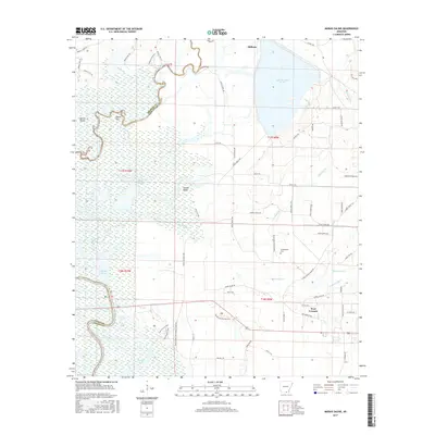
2017 Map of Marais Saline
USGS Topo · Published 2017About this map
The Saline River and Ouachita River converge amidst a vast network of wetlands and seasonal waterways in this southeastern Arkansas landscape. The terrain is defined by low-lying bottomlands, including named features like Horton Island and Round Turn, which sit alongside the expansive Lake Georgia-Pacific. This 2017 survey details the complex hydrography where Miller Br, Carroll Slough, and Big Brushy Cr cross county lines between Bradley, Ashley, and Union counties.
Find a feature on this map
68 named features on this map. Tap any name to fly to it.
Don’t see what you’re looking for? This feature index may not catch every label — zoom into the map to look around manually.
Map Details
Editions of this 2017 Marais Saline Map
This is the sole edition of this map. No revisions or reprints were ever made.
Other maps of this area

1934 · Ingalls
USGS Topo · 1:48,000

1934 · Felsenthal
USGS Topo · 1:62,500

1937 · Felsenthal
USGS Topo · 1:62,500

1937 · Ingalls
USGS Topo · 1:62,500

1938 · Felsenthal
USGS Topo · 1:62,500

1939 · Felsenthal
USGS Topo · 1:62,500

1939 · Ingalls
USGS Topo · 1:62,500

1953 · Greenwood
USGS Topo · 1:250,000

1953 · El Dorado
USGS Topo · 1:250,000

1956 · Greenwood
USGS Topo · 1:250,000