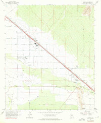
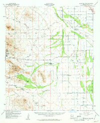
1967 Map of Marana
USGS Topo · Published 1976About this map
The Southern Pacific railroad corridor dictates the settlement pattern of this desert landscape, linking the growing town of Marana with the nearby community of Rillito. Education is a focal point for the local community, evidenced by the presence of Marana High Sch and a Jr High Sch. The terrain is defined by the ephemeral Santa Cruz River and the broad Avra Valley, set against the rising slopes of the Tortolita Mountains.
Find a feature on this map
36 named features on this map. Tap any name to fly to it.
Don’t see what you’re looking for? This feature index may not catch every label — zoom into the map to look around manually.
Map Details
Editions of this 1967 Marana Map
4 editions found
Other maps of this area

1934 · Tucson Mountains
USGS Topo · 1:125,000

1934 · Newman Peak
USGS Topo · 1:125,000

1947 · Cortaro
USGS Topo · 1:62,500

1947 · Red Rock
USGS Topo · 1:62,500

1956 · Tucson
USGS Topo · 1:250,000

1957 · Cortaro
USGS Topo · 1:62,500

1958 · Tucson
USGS Topo · 1:250,000

1959 · Tucson
USGS Topo · 1:250,000

1959 · Tortolita Mts
USGS Topo · 1:62,500
1959 · Silver Bell Peak
USGS Topo · 1:62,500