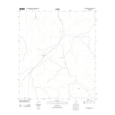
2012 Map of Marathon Gap
USGS Topo · Published 2012About this map
Marathon Gap serves as a prominent natural passage in this Pecos County landscape, where the terrain is marked by isolated elevations and ranching infrastructure. The presence of the Allison Ranch Airport centered between the gap and Clark Butte indicates the logistical requirements of managing large-scale land holdings in this part of West Texas. Transport patterns are defined by long-established routes such as Wagon Rd and Longfellow Rd, which trace the drainage and topographic contours of the region. The map reflects a modern era of land use where historic names for natural features and trails persist alongside contemporary aviation and road networks, providing a clear view of how these remote properties are accessed and navigated.
Find a feature on this map
6 named features on this map. Tap any name to fly to it.
Don’t see what you’re looking for? This feature index may not catch every label — zoom into the map to look around manually.
Map Details
Editions of this 2012 Marathon Gap Map
This is the sole edition of this map. No revisions or reprints were ever made.
Other maps of this area

1920 · Longfellow
USGS Topo · 1:125,000

1923 · Hess Canyon
USGS Topo · 1:62,500

1923 · Sierra Madera
USGS Topo · 1:62,500

1928 · Comanche Spring
USGS Topo · 1:125,000

1929 · Hovey
USGS Topo · 1:125,000

1954 · Fort Stockton
USGS Topo · 1:250,000

1958 · Fort Stockton
USGS Topo · 1:250,000

1968 · Cap Rock Butte
USGS Topo · 1:24,000

1968 · Marathon Gap
USGS Topo · 1:24,000

1968 · Dimple Hills
USGS Topo · 1:24,000