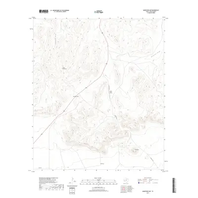
2019 Map of Marathon Gap
USGS Topo · Published 2019About this map
The Glass Mountains dominate the northwestern landscape of this Pecos County region, where the terrain breaks at the significant passage known as Marathon Gap. This high-desert environment is characterized by dramatic elevation shifts and seasonal drainage systems like Sixshooter Draw and Nineteen Draw. Transportation through this isolated territory is anchored by the presence of US Route 385, which follows the natural corridor through the gap, and secondary routes such as Longfellow Rd and the historical Wagon Rd.
Find a feature on this map
10 named features on this map. Tap any name to fly to it.
Don’t see what you’re looking for? This feature index may not catch every label — zoom into the map to look around manually.
Map Details
Editions of this 2019 Marathon Gap Map
This is the sole edition of this map. No revisions or reprints were ever made.
Other maps of this area

1920 · Longfellow
USGS Topo · 1:125,000

1923 · Hess Canyon
USGS Topo · 1:62,500

1923 · Sierra Madera
USGS Topo · 1:62,500

1928 · Comanche Spring
USGS Topo · 1:125,000

1929 · Hovey
USGS Topo · 1:125,000

1954 · Fort Stockton
USGS Topo · 1:250,000

1958 · Fort Stockton
USGS Topo · 1:250,000

1968 · Cap Rock Butte
USGS Topo · 1:24,000

1968 · Marathon Gap
USGS Topo · 1:24,000

1968 · Dimple Hills
USGS Topo · 1:24,000