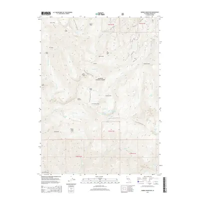
2015 Map of Marble Mountain
USGS Topo · Published 2015About this map
Marble Mountain and the surrounding high-elevation wilderness are the centerpiece of this study within the Klamath National Forest. The landscape is defined by a dense network of glacial basins and alpine lakes, including the uniquely named Man Eaten Lake, Frying Pan Lake, and the cluster of Upper and Lower Sky High Lake. The Pacific Crest National Scenic Trail winds through the center of the quadrangle, providing a continuous corridor through high-country landmarks like Black Marble Mtn and Kings Castle. The map documents the intricate hydrography of the region, where the headwaters of Wooley Cr, Elk Cr, and Canyon Cr drain the steep slopes of Cayenne Ridge and Hummocky Ridge. This record preserves the precise location of remote water sources such as Salt Water Spring and Cold Spring alongside distinctive landforms like the Jumpoff and Dads Pocket.
Find a feature on this map
54 named features on this map. Tap any name to fly to it.
Don’t see what you’re looking for? This feature index may not catch every label — zoom into the map to look around manually.
Map Details
Editions of this 2015 Marble Mountain Map
This is the sole edition of this map. No revisions or reprints were ever made.
Other maps of this area

1914 · Seiad
USGS Topo · 1:125,000

1922 · Seiad
USGS Topo · 1:125,000

1948 · Weed
USGS Topo · 1:250,000

1950 · Weed
USGS Topo · 1:250,000

1955 · Sawyers Bar
USGS Topo · 1:62,500

1955 · Ukonom Lake
USGS Topo · 1:62,500

1955 · Scott Bar
USGS Topo · 1:62,500

1955 · Forks of Salmon
USGS Topo · 1:62,500

1958 · Weed
USGS Topo · 1:250,000

1963 · Weed
USGS Topo · 1:250,000