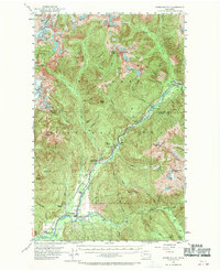
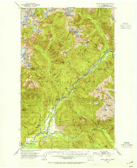
1953 Map of Marblemount
USGS Topo · Published 1970About this map
The Skagit River valley and its surrounding peaks define this mid-century survey of the North Cascades. The settlement of Marblemount serves as a focal point where the Skagit River meets the Cascade River, supporting local industry such as the Skagit Talc Mine and the State Fish Hatchery. The map documents a critical infrastructure network along the river, including a series of railroad sidings like Goodell Siding, Sky Creek Siding, and Jennings Siding that once facilitated movement through the steep terrain.
Find a feature on this map
63 named features on this map. Tap any name to fly to it.
Don’t see what you’re looking for? This feature index may not catch every label — zoom into the map to look around manually.
Map Details
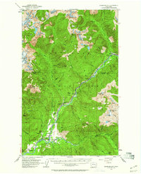
Editions of this 1953 Marblemount Map
3 editions found
Other maps of this area

1899 · Glacier Peak
USGS Topo · 1:125,000

1899 · Stillaguamish
USGS Topo · 1:125,000

1901 · Glacier Peak
USGS Topo · 1:125,000

1901 · Stilaguamish
USGS Topo · 1:125,000

1909 · Mt Baker
USGS Topo · 1:192,000

1915 · Mt. Baker
USGS Topo · 1:250,000
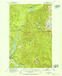
1952 · Lake Shannon
USGS Topo · 1:62,500
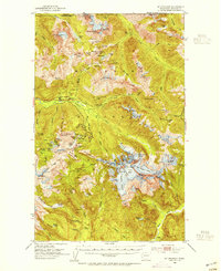
1953 · Mt Shuksan
USGS Topo · 1:62,500
1953 · Marblemount
USGS Topo · 1:62,500
1953 · Mt Challenger
USGS Topo · 1:62,500