
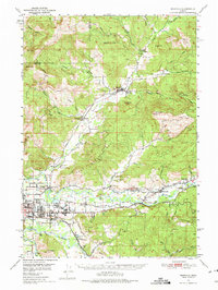
1950 Map of Marcola
USGS Topo · Published 1955About this map
The Mohawk River and McKenzie River valleys define the geography of this mid-century survey, showcasing a landscape of timber and agriculture. To the north, the timber-dependent community of Wendling and the settlement of Marcola serve as hubs along the Southern Pacific rail line, which snakes through the valley following the river. The southern portion of the map transition into the burgeoning outskirts of Springfield, where industrial infrastructure like a Filtration Plant and Power Plant appear alongside established landmarks such as the Hayden Bridge. Local life is anchored by numerous rural institutions, including the Yarnell Church and schools like Mohawk Union HS and Camp Creek Sch. Genealogists will find value in the detailed placement of the Camp Creek Cemetery and Mt Vernon Cem, which stand near the convergence of the Willamette River Middle Fork.
Find a feature on this map
54 named features on this map. Tap any name to fly to it.
Don’t see what you’re looking for? This feature index may not catch every label — zoom into the map to look around manually.
Map Details
Editions of this 1950 Marcola Map
2 editions found
Other maps of this area

1909 · Rowland
USGS Topo · 1:31,680

1910 · Eugene
USGS Topo · 1:62,500

1912 · Halsey
USGS Topo · 1:62,500

1921 · Brownsville
USGS Topo · 1:62,500

1921 · Cottage Grove
USGS Topo · 1:62,500

1935 · Lowell
USGS Topo · 1:96,000

1940 · Eugene
USGS Topo · 1:62,500

1941 · Halsey
USGS Topo · 1:62,500

1942 · Lowell
USGS Topo · 1:125,000

1946 · Eugene
USGS Topo · 1:62,500