Old Maps of Linn County, Oregon
Explore 422 old maps of Linn County, spanning from 1909 to today. These high-resolution historic maps reveal how streets, neighborhoods, landmarks, and natural features evolved over time — perfect for genealogy, metal detecting, research, and local history exploration.
What you can do with these maps:
- See how Linn County changed over time: Compare historical maps to modern-day views to trace roads, homesites, rail lines & more.
- View detailed metadata: Each map includes creators, publishers, year, scale, and archive source.
- Overlay maps with satellite & LiDAR: Visualize the past alongside modern tools to explore terrain & human change.
- Trusted historical sources: Maps sourced from the USGS, Library of Congress, and other archives.
- Access maps your way: View online, download high-res files, or order prints for personal or research use.
Start exploring old maps of Linn County to uncover forgotten places, hidden landmarks, and the deep history beneath your feet.
Linn County, OR maps
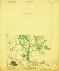
(422)- 1909 Map of Harrisburg
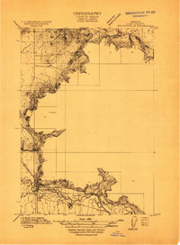
 1909 Harrisburg1909 Print · USGSThe Willamette Valley at the end of the first decade of the twentieth century shows a landscape tied to both river and rail. Researchers can trace the early road network like Halsey Road and locate numerous local landmarks like Ingrams Ferry or the Muddy School.
 - 1909 Map of Rowland
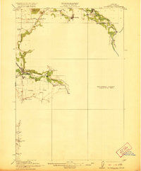
 1909 Rowland1909 Print · USGSLinn County agriculture and rural life are captured in the early 1900s, showing a landscape of scattered schoolhouses and rail lines. You can trace early family sites near the Southern Pacific Railroad and locate community landmarks like Rowland and Cherry Center School.
 - 1910 Map of Eugene
 1910 Eugene1910 Print · USGSThe upper Willamette Valley comes to life in the years before the Great War, centered on the growing campus of the University of Oregon. Genealogists can trace family footprints across dozens of local school districts like Santa Clara and Deadman, or follow the early tracks of the Oregon Electric RR.2 unique versions available
 - 1911 Map of Brownsville
 1911 Brownsville1911 Print · USGSBrownsville and the surrounding Linn County valley floor appear here during the early twentieth century. Genealogists and local historians can trace the early rail corridor of the Southern Pacific and locate rural landmarks like Rock Hill School and Warren School.
 - 1911 Map of Lebanon
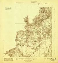
 1911 Lebanon1911 Print · USGSLinn County agriculture and rail travel are in full bloom here in the decade before the First World War. Researchers can trace the early foundations of Lebanon or locate specific country schoolhouses like Gore School and Stoltz Hill School near the base of Peterson Butte.
 - 1911 Map of Tangent
 1911 Tangent1911 Print · USGSLinn County’s fertile valley was a hive of rail activity and rural education in the early twentieth century. Genealogists can locate family landmarks like Oak Creek Church and several rural schoolhouses, including Flunow School and Midway School.
 - 1912 Map of Jefferson
 1912 Jefferson1912 Print · USGSThe Willamette Valley at the height of the pre-war rail era shows a landscape of river-bend towns and rural school districts. Genealogists can locate family lands near Millersburg or trace the routes of the Oregon Electric and Corvallis and Eastern railroads.
 - 1912 Map of Halsey
 1912 Halsey1912 Print · USGSThe Willamette Valley’s fertile floor and expanding rail networks are documented here just before the era of modern highways. Local historians can locate numerous vanished rural landmarks, from the Ingram Ferry crossing to schoolhouses like Bell Plain School and Harris School.3 unique versions available
 - 1913 Map of Philomath
 1913 Philomath1913 Print · USGSBenton County was a bustling hub of education and steam-era transport just before the First World War. Genealogists and rail historians can trace the early footprint of Oregon Agricultural College and the complex routes of the Corvallis and Eastern or find local burial sites like Newton Cem.
 - 1913 Map of Oakville
 1913 Oakville1913 Print · USGSThe Willamette Valley’s complex river system and early rail network come alive in this pre-World War I survey of the Linn and Benton county line. Genealogists and historians can trace defunct river crossings like Fisher Ferry and rural landmarks such as Oakville Sta and Dixie Sch.
 - 1913 Map of Wells
 1913 Wells1913 Print · USGSBenton and Polk counties are mapped here before the First World War, showing a Willamette Valley landscape defined by rail-stop settlements and riverside sloughs. Researchers can trace the development of Suver and Granger, or locate the historic State Game Farm and Suver Cem.
 - 1914 Map of Independence
 1914 Independence1914 Print · USGSIn the early twentieth century, the Willamette Valley was a bustling network of river landings and short-line railroads. Trace the routes of the Valley and Siletz RR or locate family sites like Highland School and Buena Vista along the river.
 - 1915 Map of Sidney
 1915 Sidney1915 Print · USGSMarion County's riverfront and rail corridors are captured here just before the First World War, showing a landscape of mills and tight-knit rural schools. Researchers can locate stops on the Oregon Electric line and local landmarks like Sidney Mills and Looney Butte.
 - 1916 Map of Albany
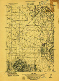
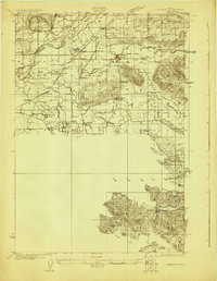
 1916 Albany1916 Print · USGSThe Willamette Valley thrives at a peak of rail and river activity in the early twentieth century. Genealogists and local historians can trace rural school districts like Dixie School, early river crossings such as Fisher Ferry, and the original paths of the Southern Pacific railroad.4 unique versions available
 - 1917 Map of Salem
 1917 Salem1917 Print · USGSThe Willamette Valley at the peak of its rail-and-river era shows a landscape of growing towns and specialized state institutions. Researchers can trace early family-named junctions and rural educational sites like Grabenhorst Corners, Keizer School, and Wigrich Landing.3 unique versions available
 - 1921 Map of Brownsville
 1921 Brownsville1921 Print · USGSLinn County agriculture and early rail travel define this landscape in the years following the Great War. Genealogists can trace the rural communities surrounding Brownsville through the locations of the Union Point School, Diamond Hill School, and the Southern Pacific line.4 unique versions available
 - 1921 Map of Lebanon
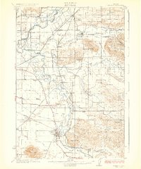
 1921 Lebanon1921 Print · USGSLinn County at the dawn of the 1920s reveals a landscape of thriving rural schools and expanding rail lines. Trace family roots and early farmstead locations near Lebanon, Tallman, and the South Santiam River.
 - 1921 Map of Corvallis
 1921 Corvallis1921 Print · USGSCorvallis and the surrounding Willamette Valley are captured in the early twentieth century as the region's agricultural and educational roots were deepening. Researchers can trace rural schoolhouse locations like Witham School and family-named landmarks such as Smith Hill or the Mt Union Cemetery.5 unique versions available
 - 1922 Map of Lebanon
 1922 Lebanon1922 Print · USGSLinn County during the early 1920s reveals a landscape of river-fed farms and burgeoning rail towns. Genealogists and historians can locate dozens of country schoolhouses like Cole School and family landmarks such as Ballins Mill and Miller Cemetery.
 - 1924 Map of Lebanon
 1924 Lebanon1924 Print · USGSLinn County agriculture and rail life are captured here in the early twenties as small communities flourished along the river forks. Researchers can trace the exact locations of many rural schoolhouses like Happy Home School and old mill sites such as Ballins Mill.3 unique versions available
 - 1925 Map of Stayton
 1925 Stayton1925 Print · USGSMarion County in the mid-1920s reveals a dense network of country schools and state institutions linked by the Southern Pacific railroad. Genealogists and historians can trace the foundations of local communities through landmarks like the State Training School, Victor Point School, and Willard Church.3 unique versions available
 - 1927 Map of Mt. Jefferson, 1956 Print
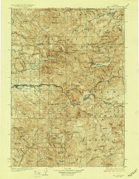
 1927 Mt. Jefferson1956 Print · USGSThe Oregon Cascades in the late twenties were defined by high-altitude trails and the early management of the Santiam and Mount Hood forests. Trace the historic Skyline Trail past remote outposts like Lemiti Ranger Sta and the Breitenbush Hot Sprs.2 unique versions available
 - 1929 Map of Mill City
 1929 Mill City1929 Print · USGSThe Oregon Cascades appear here in the late 1920s as a hub of timber, mining, and early forest management. Genealogists and historians can trace the Southern Pacific rail line through Mill City or locate remote sites like the Silver King Mine and Elkhorn School.4 unique versions available
 - 1929 Map of Three Sisters, 1956 Print
 1929 Three Sisters1956 Print · USGSThe High Cascades meet the Deschutes plateau in the late 1920s, a time when fire lookouts and cow camps dotted the volcanic peaks. Genealogists and historians can trace the early footprints of Sisters, Camp Sherman, and the historic Old Toll Station.2 unique versions available
 - 1930 Map of Mt. Jefferson
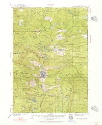
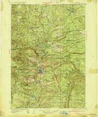 1930 Mt. Jefferson1930 Print · USGSThe Oregon Cascades were a frontier of early forest management and tribal lands during the late 1920s. Researchers can locate remote administrative outposts like the Lemiti Ranger Sta, trace the thermal waters of Breitenbush Hot Sprs, and explore the high meadows of Independence Prairie.3 unique versions available
Showing maps 1-25 of 422
Top cities of Linn County
- Lebanon historical maps
- Sweet Home historical maps
- Harrisburg historical maps
- Brownsville historical maps
- Lyons historical maps
- Tangent historical maps
See more
Frequently asked questions
- What are the different types of historical maps available for Linn County?
- What is the oldest map of Linn County?
- Where can I purchase historical maps of Linn County for my home or office?
- Where can I download high-res historical maps of Linn County?
- Are there historical topographic maps available for Linn County?
- Is there historical aerial imagery available for Linn County?
- Where are historical maps of Linn County sourced from?