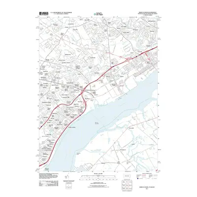
2011 Map of Marcus Hook
USGS Topo · Published 2011About this map
The Delaware River forms the industrial and maritime heart of this 2011 survey, where the borders of Pennsylvania, Delaware, and New Jersey converge. The riverfront is dominated by the established ports of Marcus Hook and Trainer, while the inland landscape is shaped by the complex drainage of Chester Creek, Naamans Creek, and Oldmans Creek. This era reveals a dense network of suburban development and historical industry, indicated by legacy sites like Llewellyn Mill Dam, Duttons Mill, and Hickmans Mill.
Find a feature on this map
338 named features on this map. Tap any name to fly to it.
Don’t see what you’re looking for? This feature index may not catch every label — zoom into the map to look around manually.
Map Details
Editions of this 2011 Marcus Hook Map
This is the sole edition of this map. No revisions or reprints were ever made.
Other maps of this area

1890 · Salem
USGS Topo · 1:62,500

1894 · Chester
USGS Topo · 1:62,500

1896 · Chester
USGS Topo · 1:62,500

1898 · Salem
USGS Topo · 1:62,500

1898 · Chester
USGS Topo · 1:62,500

1901 · Camden
USGS Topo · 1:125,000

1901 · West Chester
USGS Topo · 1:62,500

1904 · West Chester
USGS Topo · 1:62,500

1904 · Wilmington
USGS Topo · 1:62,500

1906 · Wilmington
USGS Topo · 1:62,500