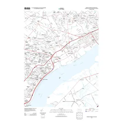
2013 Map of Marcus Hook
USGS Topo · Published 2013About this map
The Delaware River serves as the central artery for this industrial and residential corridor where Pennsylvania, Delaware, and New Jersey converge. In the early 21st century, the riverfront is dominated by navigation markers like the Marcus Hook Range and the Bellevue Range, reflecting the area's enduring importance to maritime commerce. Inland, the landscape is a dense network of established neighborhoods and newer developments such as Creekside Village at Naamans and Garnet Oaks, stitched together by major transit lines including I-95 and Us 13.
Find a feature on this map
143 named features on this map. Tap any name to fly to it.
Don’t see what you’re looking for? This feature index may not catch every label — zoom into the map to look around manually.
Map Details
Editions of this 2013 Marcus Hook Map
This is the sole edition of this map. No revisions or reprints were ever made.
Other maps of this area

1890 · Salem
USGS Topo · 1:62,500

1894 · Chester
USGS Topo · 1:62,500

1896 · Chester
USGS Topo · 1:62,500

1898 · Salem
USGS Topo · 1:62,500

1898 · Chester
USGS Topo · 1:62,500

1901 · Camden
USGS Topo · 1:125,000

1901 · West Chester
USGS Topo · 1:62,500

1904 · West Chester
USGS Topo · 1:62,500

1904 · Wilmington
USGS Topo · 1:62,500

1906 · Wilmington
USGS Topo · 1:62,500