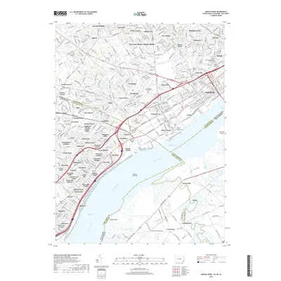
2019 Map of Marcus Hook
USGS Topo · Published 2019About this map
The Delaware River serves as the industrial and navigational spine for this tri-state border region where Pennsylvania, Delaware, and New Jersey converge. In the years following the millennium, the landscape reveals a dense network of transit and community history, with the massive presence of CSX Transportation and Septa rail lines cutting through established neighborhoods like Twin Oaks and Linwood. Local genealogy is well-preserved through numerous historic burial grounds, including the Old Saint Martins Episcopal Cem and the Siloam Methodist Cem. The industrial character of Chester and Marcus Hook is balanced by educational landmarks such as Neumann College and the various residential developments like Naamans Manor and Garnet Valley. Critical infrastructure, such as the Naamans Bridge and the Marcus Hook Range, highlights the ongoing importance of the river for regional logistics and commerce.
Find a feature on this map
134 named features on this map. Tap any name to fly to it.
Don’t see what you’re looking for? This feature index may not catch every label — zoom into the map to look around manually.
Map Details
Editions of this 2019 Marcus Hook Map
This is the sole edition of this map. No revisions or reprints were ever made.
Other maps of this area

1890 · Salem
USGS Topo · 1:62,500

1894 · Chester
USGS Topo · 1:62,500

1896 · Chester
USGS Topo · 1:62,500

1898 · Salem
USGS Topo · 1:62,500

1898 · Chester
USGS Topo · 1:62,500

1901 · Camden
USGS Topo · 1:125,000

1901 · West Chester
USGS Topo · 1:62,500

1904 · West Chester
USGS Topo · 1:62,500

1904 · Wilmington
USGS Topo · 1:62,500

1906 · Wilmington
USGS Topo · 1:62,500