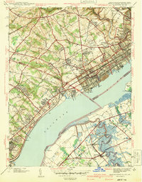
1941 Map of Marcus Hook
USGS Topo · Published 1941About this map
Marcus Hook dominates the shoreline in this pre-war survey, serving as a critical junction for the Pennsylvania RR, Baltimore and Ohio RR, and Reading RR. The industrial and maritime character of the riverfront is evident through the presence of the U S Quarantine Sta and a sprawling U S Military Reservation situated across the Delaware River on the New Jersey side. The map documents the dense transition from urban centers like Claymont and Upland to the rural crossroads of Delaware County.
Find a feature on this map
102 named features on this map. Tap any name to fly to it.
Don’t see what you’re looking for? This feature index may not catch every label — zoom into the map to look around manually.
Map Details
Editions of this 1941 Marcus Hook Map
This is the sole edition of this map. No revisions or reprints were ever made.
Other maps of this area

1890 · Salem
USGS Topo · 1:62,500

1894 · Chester
USGS Topo · 1:62,500

1896 · Chester
USGS Topo · 1:62,500

1898 · Salem
USGS Topo · 1:62,500

1898 · Chester
USGS Topo · 1:62,500

1901 · Camden
USGS Topo · 1:125,000

1901 · West Chester
USGS Topo · 1:62,500

1904 · West Chester
USGS Topo · 1:62,500

1904 · Wilmington
USGS Topo · 1:62,500

1906 · Wilmington
USGS Topo · 1:62,500