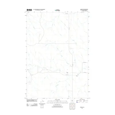
2012 Map of Marcus
USGS Topo · Published 2012About this map
Marcus sits at the heart of this Meade County landscape, where the prairie is defined by the winding course of Cherry Cr and White Owl Cr. The rural infrastructure of the early 21st century is meticulously documented here, showing a network of ranch and county roads that navigate the local topography. Notable landmarks include the small reservoir of Ensor Lake and the natural drainage of Murray Draw.
Find a feature on this map
12 named features on this map. Tap any name to fly to it.
Don’t see what you’re looking for? This feature index may not catch every label — zoom into the map to look around manually.
Map Details
Editions of this 2012 Marcus Map
This is the sole edition of this map. No revisions or reprints were ever made.
Other maps of this area

1953 · Rapid City
USGS Topo · 1:250,000

1957 · Rapid City
USGS Topo · 1:250,000

1983 · Whiteman Owl NW
USGS Topo · 1:24,000

1983 · Plainview
USGS Topo · 1:24,000

1983 · Whiteman Owl
USGS Topo · 1:24,000
1983 · Whiteman Owl SE
USGS Topo · 1:24,000

1983 · Opal East SW
USGS Topo · 1:24,000
1983 · Reed Dam
USGS Topo · 1:24,000

1983 · Marcus
USGS Topo · 1:24,000
1983 · Opal East SE
USGS Topo · 1:24,000