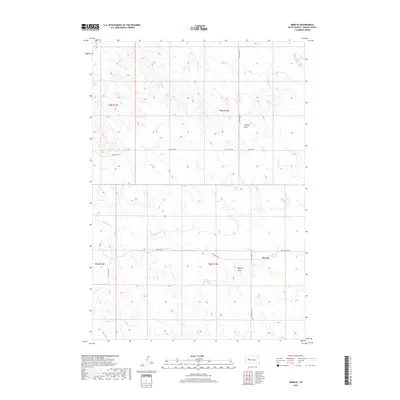
2017 Map of Marcus
USGS Topo · Published 2017About this map
The small settlement of Marcus sits within the vast drainage basins of Meade County, where several seasonal watercourses converge. In the early 21st century, the landscape remains defined by its hydrological features, including the meandering paths of Red Owl Cr and White Owl Cr. A local concentration of names around the townsite, such as Ensor Lake and Murray Draw, suggests a center of activity in an otherwise sparsely populated ranching region.
Find a feature on this map
18 named features on this map. Tap any name to fly to it.
Don’t see what you’re looking for? This feature index may not catch every label — zoom into the map to look around manually.
Map Details
Editions of this 2017 Marcus Map
This is the sole edition of this map. No revisions or reprints were ever made.
Other maps of this area

1953 · Rapid City
USGS Topo · 1:250,000

1957 · Rapid City
USGS Topo · 1:250,000

1983 · Whiteman Owl NW
USGS Topo · 1:24,000

1983 · Plainview
USGS Topo · 1:24,000

1983 · Whiteman Owl
USGS Topo · 1:24,000
1983 · Whiteman Owl SE
USGS Topo · 1:24,000

1983 · Opal East SW
USGS Topo · 1:24,000
1983 · Reed Dam
USGS Topo · 1:24,000

1983 · Marcus
USGS Topo · 1:24,000
1983 · Opal East SE
USGS Topo · 1:24,000