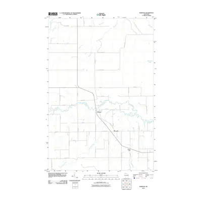
2010 Map of Marengo
USGS Topo · Published 2010About this map
Marengo and the nearby settlements of Minersville and North York anchor this northern Wisconsin landscape as it appeared in the early 21st century. The terrain is defined by the winding paths of the Marengo River and the Brunsweiler River, which snake across the central and southern portions of the quadrangle. A dense network of local roads, many bearing family names like Jolma Rd, Saari Rd, and Charlie Johnson Rd, suggests a long-standing rural community rooted in agriculture or timber. To the northeast, the isolated Moonshine Lake and various watercourses like Trout Brook and Meadow Creek highlight the drainage patterns of Ashland County. The placement of Cemetery Rd near the Brunsweiler River serves as a quiet marker of local genealogy and the historical footprint of these small townships.
Find a feature on this map
45 named features on this map. Tap any name to fly to it.
Don’t see what you’re looking for? This feature index may not catch every label — zoom into the map to look around manually.
Map Details
Editions of this 2010 Marengo Map
This is the sole edition of this map. No revisions or reprints were ever made.
Other maps of this area

1942 · Ashland
USGS Topo · 1:48,000

1942 · Mellen
USGS Topo · 1:48,000

1942 · Marengo
USGS Topo · 1:48,000

1943 · Odanah
USGS Topo · 1:48,000

1945 · Odanah
USGS Topo · 1:48,000

1945 · Marengo
USGS Topo · 1:48,000

1945 · Mellen
USGS Topo · 1:48,000

1947 · Ashland
USGS Topo · 1:48,000

1953 · Ashland
USGS Topo · 1:250,000
1956 · Mellen
USGS Topo · 1:24,000