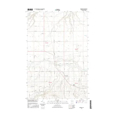
2015 Map of Marengo
USGS Topo · Published 2015About this map
Marengo sits at the heart of this Ashland County landscape, where the confluence of the Marengo River and Brunsweiler River defines the local topography. This 2015 survey reveals a pattern of rural settlement and agriculture organized around an extensive network of named local roads, including Silas Blackman Rd and Van De Bruggen Rd, which connect the small communities of Minersville and North York. The terrain is deeply carved by numerous tributaries such as Hyms Creek, Meadow Creek, and Trout Brook, reflecting the hydrology of the Wisconsin northwoods. For genealogists and local historians, the map identifies specific landmarks like the Maple Grove Cemetery and remote water bodies such as Moonshine Lake, offering a detailed view of the township’s physical and cultural geography in the early 21st century.
Find a feature on this map
70 named features on this map. Tap any name to fly to it.
Don’t see what you’re looking for? This feature index may not catch every label — zoom into the map to look around manually.
Map Details
Editions of this 2015 Marengo Map
This is the sole edition of this map. No revisions or reprints were ever made.
Other maps of this area

1942 · Ashland
USGS Topo · 1:48,000

1942 · Mellen
USGS Topo · 1:48,000

1942 · Marengo
USGS Topo · 1:48,000

1943 · Odanah
USGS Topo · 1:48,000

1945 · Odanah
USGS Topo · 1:48,000

1945 · Marengo
USGS Topo · 1:48,000

1945 · Mellen
USGS Topo · 1:48,000

1947 · Ashland
USGS Topo · 1:48,000

1953 · Ashland
USGS Topo · 1:250,000
1956 · Mellen
USGS Topo · 1:24,000