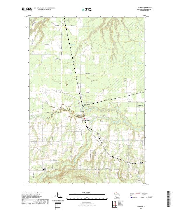
2022 Map of Marengo
USGS Topo · Published 2022About this map
The Marengo River and Brunsweiler River converge near the heart of this Northwoods landscape, framing the small settlement of Marengo. The topography is defined by the winding paths of these waterways as they cut through the northern Wisconsin terrain, supported by tributaries such as Hyms Cr and Trout Brook. Smaller communities like Minersville, North York, and Jolmaville appear along a network of rural roads, including several named for early local families such as J Pohl Rd, Charles Johnson Rd, and Silas Blackman Rd.
Find a feature on this map
72 named features on this map. Tap any name to fly to it.
Don’t see what you’re looking for? This feature index may not catch every label — zoom into the map to look around manually.
Map Details
Editions of this 2022 Marengo Map
This is the sole edition of this map. No revisions or reprints were ever made.
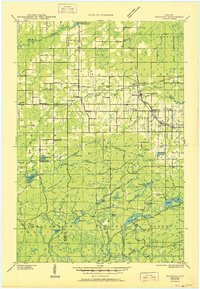
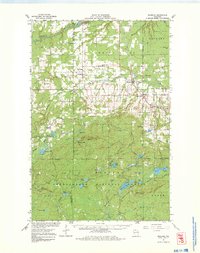
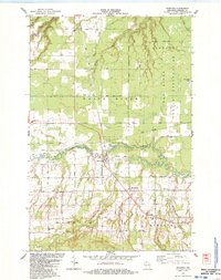
Historical Maps of Marengo Through Time
5 maps found