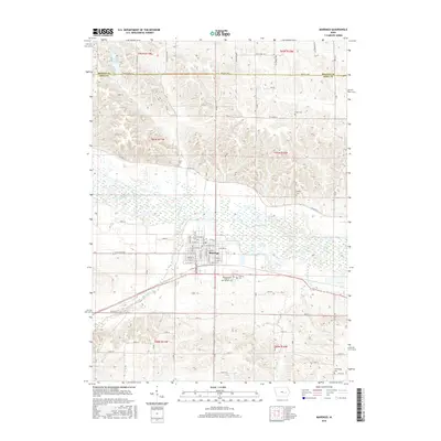
2015 Map of Marengo
USGS Topo · Published 2015About this map
Marengo stands as the central hub of this 2015 survey, situated just south of the winding Iowa River. The town's grid is remarkably detailed, showing numerous residential streets and civic landmarks such as the International Order of Odd Fellows Cem and Calvary Cem on its southern outskirts. The surrounding landscape is defined by the convergence of several waterways, including Big Bear Creek and Hilton Cr, which shape the local drainage and agricultural patterns. This map serves as an excellent resource for understanding the rural-urban interface in Iowa County, capturing several family and community burial grounds like Titler Cem, Conn Cem, and the Norwegian Cem. To the north, across the Benton Co Iowa Co line, the terrain includes Hannen Lake and several named creeks, providing a clear picture of the diverse wetland and riverine environments that characterize this portion of the Cedar River basin.
Find a feature on this map
50 named features on this map. Tap any name to fly to it.
Don’t see what you’re looking for? This feature index may not catch every label — zoom into the map to look around manually.
Map Details
Editions of this 2015 Marengo Map
This is the sole edition of this map. No revisions or reprints were ever made.
Other maps of this area

1888 · Amana
USGS Topo · 1:62,500

1889 · Amana
USGS Topo · 1:62,500

1891 · Oxford
USGS Topo · 1:62,500

1894 · Oxford
USGS Topo · 1:62,500

1899 · Amana
USGS Topo · 1:62,500

1903 · Fairfax
USGS Topo · 1:125,000

1954 · Des Moines
USGS Topo · 1:250,000

1956 · Des Moines
USGS Topo · 1:250,000

1957 · Des Moines
USGS Topo · 1:250,000

1958 · Davenport
USGS Topo · 1:250,000