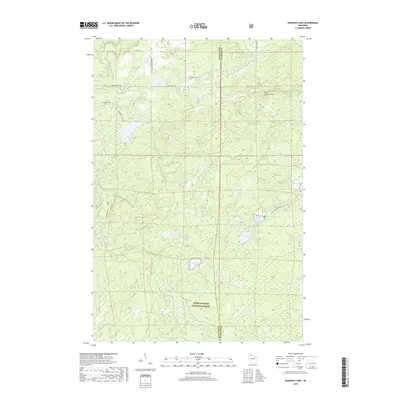
2018 Map of Marengo Lake
USGS Topo · Published 2018About this map
Saint Peters Dome rises as a prominent landmark in this heavily forested landscape within the Chequamegon National Forest. The 2018 survey reveals a terrain defined by its complex hydrography, where the Marengo River and Whiskey Cr carve through the glacial geography of the Wisconsin Northwoods. The N Country National Scenic Trail winds through the central portion of the map, providing a glimpse into the modern recreational use of this timberland. Evidence of local connectivity is found in the network of Forest Service roads, such as FR 383 and FR 384, alongside named routes like Four Corners Store Rd and Kyster Rd. The map documents a diverse collection of water bodies, from the secluded Tea Lake and Coffee Lake to the more significant Birch Lake and Morgan Falls, illustrating the headwater patterns that define the Ashland and Bayfield county line.
Find a feature on this map
27 named features on this map. Tap any name to fly to it.
Don’t see what you’re looking for? This feature index may not catch every label — zoom into the map to look around manually.
Map Details
Editions of this 2018 Marengo Lake Map
This is the sole edition of this map. No revisions or reprints were ever made.
Other maps of this area

1942 · Clam Lake
USGS Topo · 1:48,000

1942 · Marengo
USGS Topo · 1:48,000

1943 · Namekagon Lake
USGS Topo · 1:48,000

1944 · Grandview
USGS Topo · 1:48,000

1945 · Namekagon Lake
USGS Topo · 1:48,000

1945 · Marengo
USGS Topo · 1:48,000

1945 · Clam Lake
USGS Topo · 1:48,000

1947 · Grandview
USGS Topo · 1:48,000

1953 · Ashland
USGS Topo · 1:250,000

1958 · Ashland
USGS Topo · 1:250,000