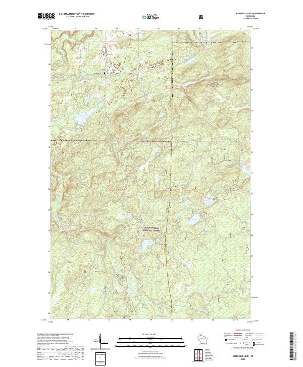
2022 Map of Marengo Lake
USGS Topo · Published 2022About this map
The Chequamegon National Forest encompasses the vast majority of this Northwoods landscape, where the Bayfield and Ashland County line divides a terrain defined by glacial lakes and sharp elevation shifts. Central to the topography is Saint Peters Dome, a prominent height accessible via the St Peter's Dome Trl, which offers views over the dense forest canopy. Nearby, Morgan Falls marks a significant hydrological feature, with its namesake Morgan Falls Trl providing passage through the wooded draws. The northern section contains more established local landmarks, including the Birch Lake Cem near the intersection of Kyster Rd and Four Corners Store Rd. Numerous water bodies like Marengo Lake, Birch Lake, and the remote Tea Lake are connected by a network of forest roads and the significant North Country National Scenic Trl, illustrating the region's character as a modern wilderness protected by federal stewardship.
Find a feature on this map
39 named features on this map. Tap any name to fly to it.
Don’t see what you’re looking for? This feature index may not catch every label — zoom into the map to look around manually.
Map Details
Editions of this 2022 Marengo Lake Map
This is the sole edition of this map. No revisions or reprints were ever made.
Other maps of this area

1942 · Clam Lake
USGS Topo · 1:48,000

1942 · Marengo
USGS Topo · 1:48,000

1943 · Namekagon Lake
USGS Topo · 1:48,000

1944 · Grandview
USGS Topo · 1:48,000

1945 · Namekagon Lake
USGS Topo · 1:48,000

1945 · Marengo
USGS Topo · 1:48,000

1945 · Clam Lake
USGS Topo · 1:48,000

1947 · Grandview
USGS Topo · 1:48,000

1953 · Ashland
USGS Topo · 1:250,000

1958 · Ashland
USGS Topo · 1:250,000