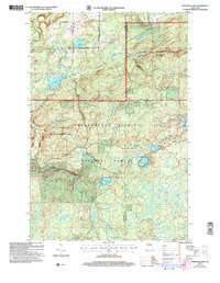
2005 Map of Marengo Lake
USGS Topo · Published 2006About this map
The Chequamegon Nicolet National Forest encompasses this landscape of glacial lakes and river headwaters along the border of Bayfield Co and Ashland Co. Settlement is concentrated in the northern portion of the map, centered around the Trinity Ch and early infrastructure like Marengo Road and Vailacourt Rd. Several Gravel Pits indicate local industry scattered among the timberlands.
Find a feature on this map
29 named features on this map. Tap any name to fly to it.
Don’t see what you’re looking for? This feature index may not catch every label — zoom into the map to look around manually.
Map Details
Editions of this 2005 Marengo Lake Map
This is the sole edition of this map. No revisions or reprints were ever made.
Other maps of this area

1942 · Clam Lake
USGS Topo · 1:48,000

1942 · Marengo
USGS Topo · 1:48,000

1943 · Namekagon Lake
USGS Topo · 1:48,000

1944 · Grandview
USGS Topo · 1:48,000

1945 · Namekagon Lake
USGS Topo · 1:48,000

1945 · Marengo
USGS Topo · 1:48,000

1945 · Clam Lake
USGS Topo · 1:48,000

1947 · Grandview
USGS Topo · 1:48,000

1953 · Ashland
USGS Topo · 1:250,000

1958 · Ashland
USGS Topo · 1:250,000