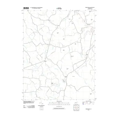
2010 Map of Maretburg
USGS Topo · Published 2010About this map
Maretburg and Level Green anchor this topographic view of Rockcastle County, where a series of prominent ridges and knobs define the local landscape. The terrain is characterized by high points such as Pinnacle Knob, Cable Knob, and the distinctive Backbone Ridge in the northeast corner. This 2010 survey shows a network of rural roads, many bearing family names like Gentry Laswell Rd and Charlie Todd Rd, which reflect the long-standing community ties in this part of Kentucky.
Find a feature on this map
68 named features on this map. Tap any name to fly to it.
Don’t see what you’re looking for? This feature index may not catch every label — zoom into the map to look around manually.
Map Details
Editions of this 2010 Maretburg Map
This is the sole edition of this map. No revisions or reprints were ever made.
Other maps of this area

1893 · London
USGS Topo · 1:125,000

1897 · London
USGS Topo · 1:125,000

1935 · Somerset
USGS Topo · 1:62,500

1952 · Crab Orchard
USGS Topo · 1:24,000

1952 · Billows
USGS Topo · 1:24,000

1952 · Shopville
USGS Topo · 1:24,000

1952 · Woodstock
USGS Topo · 1:24,000

1953 · Maretburg
USGS Topo · 1:24,000

1953 · Wildie
USGS Topo · 1:24,000
1953 · Brodhead
USGS Topo · 1:24,000