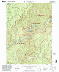
1998 Map of Marial
USGS Topo · Published 2001About this map
The Rogue River carves a deep path through the Siskiyou National Forest in this 1998 revision, which documents a landscape defined by its remote river-access settlements and treacherous water features. At the heart of the map is the isolated settlement of Marial, situated near the Rogue River Ranch and a small Cem, marking a rare pocket of habitation in the Wild Rogue Wilderness. The river's character is evidenced by a series of named hazards and landmarks, from the technical waters of Blossom Bar Rapids and Clay Hill Rapids to the Devils Stairs. Evidence of forest management and backcountry travel is clear, with a Landing Strip near Paradise Creek and the National Scenic Trail winding along the steep terrain. Landforms like Hanging Rock and Mule Mountain provide prominent vertical relief in this roadless territory.
Find a feature on this map
54 named features on this map. Tap any name to fly to it.
Don’t see what you’re looking for? This feature index may not catch every label — zoom into the map to look around manually.
Map Details
Editions of this 1998 Marial Map
This is the sole edition of this map. No revisions or reprints were ever made.
Other maps of this area

1899 · Port Orford
USGS Topo · 1:125,000

1903 · Port Orford
USGS Topo · 1:125,000

1954 · Coos Bay
USGS Topo · 1:250,000

1954 · Bone Mountain
USGS Topo · 1:62,500

1954 · Marial
USGS Topo · 1:62,500

1954 · Agness
USGS Topo · 1:62,500

1954 · Powers
USGS Topo · 1:62,500

1955 · Medford
USGS Topo · 1:250,000

1957 · Medford
USGS Topo · 1:250,000

1958 · Medford
USGS Topo · 1:250,000