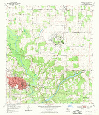
1952 Map of Marianna
USGS Topo · Published 1969About this map
Marianna serves as the regional hub in this mid-century portrait of Jackson County, where the Louisville and Nashville railroad anchors the town's grid. The landscape is defined by the winding course of the Chipola River and the significant presence of the Florida Caverns State Park to the north. Local civic life is well-documented through institutional landmarks like the Northwest Florida State Hospital and Chipola Junior College, alongside numerous rural schools such as Buckhorn Sch and Pope Sch. Genealogists will find a wealth of specific local history in the numerous burial grounds, including Orange Hill Cem, Riverside Cem, and the more remote Poplar Spring Cem near the eastern edge of the survey area. To the northeast, the settlement of Greenwood sits amidst a network of country churches like Union Hill Ch and St Mark Ch.
Find a feature on this map
31 named features on this map. Tap any name to fly to it.
Don’t see what you’re looking for? This feature index may not catch every label — zoom into the map to look around manually.
Map Details
Editions of this 1952 Marianna Map
2 editions found
Other maps of this area

1952 · Cypress
USGS Topo · 1:24,000

1952 · Oakdale
USGS Topo · 1:24,000

1952 · Kynesville
USGS Topo · 1:24,000

1952 · Dellwood
USGS Topo · 1:24,000

1952 · Cottondale East
USGS Topo · 1:24,000

1952 · Malone
USGS Topo · 1:24,000

1952 · Bascom
USGS Topo · 1:24,000

1952 · Sills
USGS Topo · 1:24,000

1952 · Marianna
USGS Topo · 1:24,000

1954 · Tallahassee
USGS Topo · 1:250,000