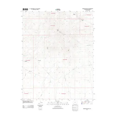
2013 Map of Mariano Wash East
USGS Topo · Published 2013About this map
Sleeping Ute Mountain dominates the northern reaches of this Montezuma County landscape, its distinctive profile marked by features such as The Knees, West Toe, and East Toe. This 2013 survey of the area around Mariano reveals a network of intermittent drainage systems, including Mariano Wash and Aztec Wash, which carve through the high-desert terrain. The map captures a moment in the early 21st century when modern infrastructure, such as Indian Rte-234 and Indian Rte-201, provides access across the tribal lands and ranching country. To the north, Sundance Ground sits near the headwaters of Fisher Cr and Cottonwood Wash, highlighting the cultural and natural geography of the Four Corners region. The settlement of Mariano serves as a primary reference point in the west, situated near the transition from upland ridges to the broader flats of Cowboy Wash.
Find a feature on this map
22 named features on this map. Tap any name to fly to it.
Don’t see what you’re looking for? This feature index may not catch every label — zoom into the map to look around manually.
Map Details
Editions of this 2013 Mariano Wash East Map
This is the sole edition of this map. No revisions or reprints were ever made.
Other maps of this area

1956 · Cortez
USGS Topo · 1:250,000

1957 · Moqui SW
USGS Topo · 1:24,000

1957 · Moqui SE
USGS Topo · 1:24,000

1958 · Sentinel Peak NW
USGS Topo · 1:24,000

1958 · Cortez SW
USGS Topo · 1:24,000

1958 · Sentinel Peak NE
USGS Topo · 1:24,000

1958 · Cortez
USGS Topo · 1:250,000

1959 · Cortez
USGS Topo · 1:250,000

1962 · Cortez
USGS Topo · 1:250,000

1966 · Cortez
USGS Topo · 1:250,000