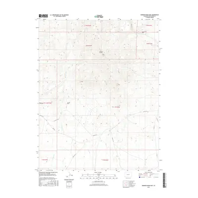
2016 Map of Mariano Wash East
USGS Topo · Published 2016About this map
Sleeping Ute Mtn dominates the skyline of this Montezuma County landscape, with its profile further defined by localized landmarks such as The Knees, W Toe, and E Toe. The settlement of Mariano sits near the western edge, positioned within a complex network of ephemeral drainages including Mariano Wash, Cowboy Wash, and Aztec Wash. These watercourses dictate the physical geography of the high desert terrain, carving paths through the diverse township and range sections. Transportation across this tribal land relies on a series of designated routes, most notably Indian Rte 201 and its predecessor, Old Indian Rte 201, which trace the lowlands alongside Aneth Rd. The map illustrates the contemporary balance between prominent geological formations and the essential road infrastructure required for traversing this part of the Ute Mountain Reservation.
Find a feature on this map
24 named features on this map. Tap any name to fly to it.
Don’t see what you’re looking for? This feature index may not catch every label — zoom into the map to look around manually.
Map Details
Editions of this 2016 Mariano Wash East Map
This is the sole edition of this map. No revisions or reprints were ever made.
Other maps of this area

1956 · Cortez
USGS Topo · 1:250,000

1957 · Moqui SW
USGS Topo · 1:24,000

1957 · Moqui SE
USGS Topo · 1:24,000

1958 · Sentinel Peak NW
USGS Topo · 1:24,000

1958 · Cortez SW
USGS Topo · 1:24,000

1958 · Sentinel Peak NE
USGS Topo · 1:24,000

1958 · Cortez
USGS Topo · 1:250,000

1959 · Cortez
USGS Topo · 1:250,000

1962 · Cortez
USGS Topo · 1:250,000

1966 · Cortez
USGS Topo · 1:250,000