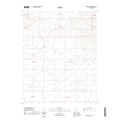
2019 Map of Mariano Wash West
USGS Topo · Published 2019About this map
Mariano Wash and Coyote Wash carve through the high desert of Montezuma County, defining the drainage patterns of this arid landscape. This 2019 survey captures a sparsely populated region of southwestern Colorado where infrastructure is primarily represented by a network of tribal and local routes, including Indian Rte 201 and Indian Rte 216. The land is segmented by an intricate grid of township and range boundaries, such as t33.5n r19w, reflecting the systematic surveying of the American West. In the northern reaches, E Mc Elmo Cr and Marble Wash contribute to the complex network of ephemeral streams and arroyos. The map is a valuable resource for understanding modern land management and the persistence of traditional movement corridors across the high plateaus.
Find a feature on this map
18 named features on this map. Tap any name to fly to it.
Don’t see what you’re looking for? This feature index may not catch every label — zoom into the map to look around manually.
Map Details
Editions of this 2019 Mariano Wash West Map
This is the sole edition of this map. No revisions or reprints were ever made.
Other maps of this area

1886 · Abajo
USGS Topo · 1:250,000

1892 · Abajo
USGS Topo · 1:250,000

1893 · Abajo
USGS Topo · 1:250,000

1956 · Cortez
USGS Topo · 1:250,000

1957 · Moqui SW
USGS Topo · 1:24,000

1957 · Moqui SE
USGS Topo · 1:24,000

1958 · Sentinel Peak NW
USGS Topo · 1:24,000

1958 · Sentinel Peak NE
USGS Topo · 1:24,000

1958 · Cortez
USGS Topo · 1:250,000
1958 · Aneth 1 SE
USGS Topo · 1:24,000