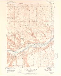
1950 Map of Mariaville
USGS Topo · Published 1950About this map
The Niobrara River carves a dramatic path through this 1950 survey, serving as the central artery for a landscape defined by ranching and rural education. This map captures the tiny settlement of Mariaville just south of the river, at a time when the region relied on a distributed network of one-room schoolhouses like School No 86, School No 69, and School No 14. The terrain is marked by distinctive family-named landmarks and water sources, including Haughin and King Hill, which stand above the drainages of Simpson Creek and Oak Creek. Genealogists will find particular value in the location of Simpson Cem and the various Windmill sites that indicate the vital infrastructure of these Nebraska sandhills. The convergence of multiple county lines, including Keya Paha, Boyd, and Holt, highlights the area's complex administrative geography.
Find a feature on this map
24 named features on this map. Tap any name to fly to it.
Don’t see what you’re looking for? This feature index may not catch every label — zoom into the map to look around manually.
Map Details
Editions of this 1950 Mariaville Map
2 editions found
Other maps of this area

1949 · Jamison SW
USGS Topo · 1:24,000

1949 · Carns
USGS Topo · 1:24,000

1950 · Carns
USGS Topo · 1:24,000

1950 · Mariaville
USGS Topo · 1:24,000

1951 · Jamison SW
USGS Topo · 1:24,000

1951 · Naper SW
USGS Topo · 1:24,000

1954 · Stuart NW
USGS Topo · 1:24,000

1954 · Newport NE
USGS Topo · 1:24,000

1955 · O'Neill
USGS Topo · 1:250,000

1959 · O'Neill
USGS Topo · 1:250,000